Southern California Fire Risks Now Tracked by Innovative Technology
In Southern California, a groundbreaking technology named AlertSoCal is set to revolutionize wildfire detection and response efforts. This innovative system is a collaboration between UC San Diego, the County of San Diego, San Diego Gas & Electric, and other key partners [1].
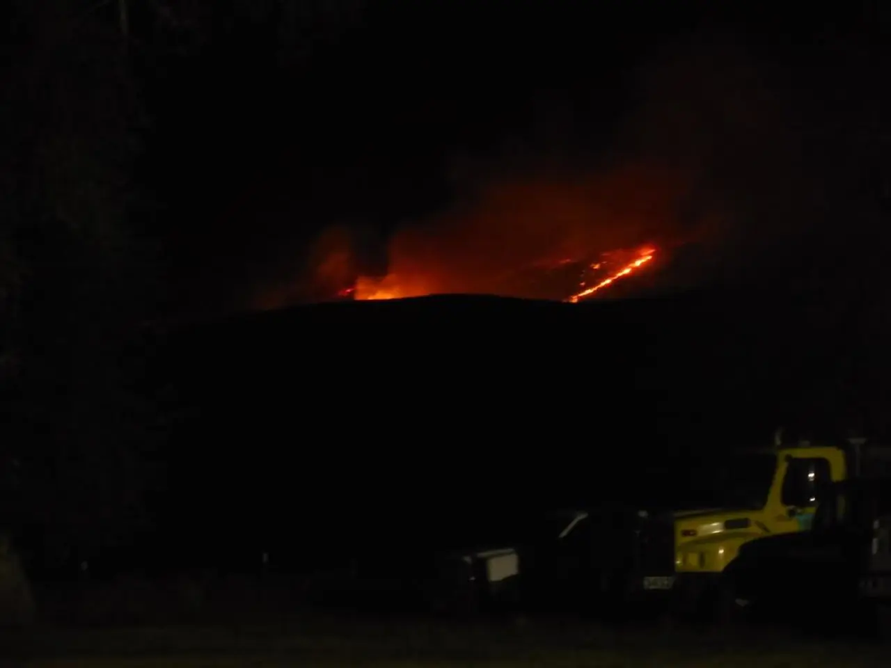
At its core, AlertSoCal operates in critical fire-prone regions, such as Toro Peak in Riverside County and Lyons Peak in southern San Diego County. The system is equipped with new 4K high-definition pan, tilt, and zoom cameras, which augment the existing High-Performance Wireless Research and Education Network (HPWREN) cameras [1].
These cameras provide 24-hour surveillance with features like near-infrared night vision, 360-degree sweeps every two minutes, and the ability to see up to 60 miles in daylight and 120 miles at night [1]. This extensive camera network captures massive amounts of data that are processed, stored, managed, and visualized by UC San Diego researchers to support wildfire detection and response efforts [1].
One of the key advantages of AlertSoCal is its integration of artificial intelligence (AI). This AI-enhanced system analyzes visual data to detect smoke and heat signatures earlier than traditional methods and often before emergency calls are made [2][3]. In 2024, the AI system detected over 1,600 fires statewide, outperforming 911 dispatch records nearly 40% of the time [2][3].
For firefighters, AlertSoCal provides precise fire location data and improved situational awareness, enabling faster and more accurate response [1][2][3]. The system complements other wildfire detection initiatives, such as satellite monitoring programs, which scan fire-prone regions from orbit every 10 to 20 minutes with improved resolution [2][3][5].
AlertSoCal is part of the broader ALERTCalifornia network, a public safety program led by UC San Diego that uses a large network of more than 1,100 high-definition, pan-tilt-zoom cameras deployed across California to monitor and detect natural disasters, including active wildfires, in real time [1].
Graham Kent, director of the Nevada Seismological Laboratory and a geophysicist at the University of Nevada, Reno, describes AlertSoCal as the 21st century's version of crowd-source fire-tower observers [4]. The system also benefits UC San Diego through research and education opportunities [4].
In addition, AlertSoCal expands Southern California's existing earthquake and weather monitoring system to better detect fires in real time. The HPWREN network includes over 64 fixed mountaintop cameras positioned in 16 remote locations across San Diego, Riverside, and Imperial counties [1]. The AlertSoCal system transmits real-time information to incident command centers and fire stations for enhanced readiness [1].
As extreme drought conditions, warmer weather, and more frequent Santa Ana wind events contribute to increased wildfire activity and longer fire seasons each year in Southern California [6], the implementation of AlertSoCal is more crucial than ever. The system is set to provide a vital tool for firefighters and emergency managers to fight wildfires more effectively [1][2][3].
[1] UC San Diego News Center
[2] UC San Diego Jacobs School of Engineering
[3] UC San Diego Scripps Institution of Oceanography
[4] University of Nevada, Reno
[5] NASA Earth Observatory
[6] California Department of Forestry and Fire Protection
Read also:
- Annual energy expenditure at the University Science Building slashes by $1.2 million, all the while adhering to environmental safety ventilation standards.
- GPS Tracking System Unveiled by RoGO Communications for Wildland Firefighting Operations
- Strategies for Minimizing Greenhouse Gas Emissions from the Built Environment
- Most Potent Nuclear Explosive Ever Constructed - Tsar Bomba


