Advanced Aerial Technologies for Landscape Design Construction
Tired of dragging out your landscape architecture projects with traditional survey methods? Say goodbye to painstaking weeks and costly site explorations - embrace the future with drone technology!
Feeling bogged down by conventional surveying techniques that leave even the smallest projects feeling like a never-ending mountain? Look no further, because drone tech is here to transform the way you approach landscape architecture and streamline your workflow like never before!
The Future is in the Air: Drones Take Over
Landscape architects are embracing the planning revolution offered by the skies thanks to drone technologies that make site analysis, design visualization, and project management a breeze. Are you ready to join the aerial revolution and take your skills to new heights?
Don't shy away from the opportunity to revolutionize your landscape architecture work with drone technology! Here's the rundown on why you'll want to be soaring to success:
What's Cooking with Drones:
- Say Adios to Time-Consuming Traditions: Reclaim your precious time and say sayonara to multi-day or even multi-week site visits. Drones can produce the same results in mere hours - a game-changer for speeding up your projects and staying on schedule!
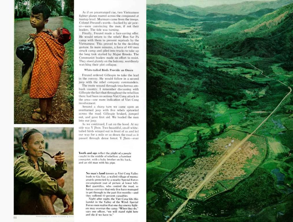
- Bye-Bye Site Barriers: No more struggling to collect data from remote or dangerous locations. Drones can navigate steep slopes, marshy areas, and thick vegetation, gathering info from spots never thought feasible without risking life or limb!
- Cost-Effective Data Collection: Don’t break the bank on pricey equipment or survey teams. Investing in drone technology will quickly generate a return on investment due to reduced labor expenses, lower equipment rental fees, and faster project completion times.
- Precision and Quality: Gone are the days of imprecise surveys and inaccurate data leading to costly revisions. High-resolution drone data ensures precise designs every time!
Drone Highlights for Site Analysis
Accurate site data is the foundation for all successful landscape architecture projects, and drone technology provides unmatched capabilities for collecting comprehensive data sets that traditional methods cannot match.
Topo Mapping and Elevation Data:
Say goodbye to days on end spent walking through a project site to develop elevation models. Drones gather thousands of elevation points in a single flight, creating highly-detailed Digital Elevation Models (DEMs) with centimeter-level precision. This data proves essential for drainage analysis, grading plans, and slope calculations, making for efficient designs from the get-go!
Vegetation Analysis:
Got greenery? Drone technology can detect plant species, evaluate their health, and map vegetation density across expansive areas. This aids in habitat restoration, urban forest management, and even identifying invasive plant species. Don't miss out on the numerous benefits for your landscape design!
Beyond Basic Image Capture: Advanced Mapping and Surveying Techniques
Drones do more than just snap pictures - they offer a variety of sophisticated features to take your site analysis further.
LiDAR Integration:
LiDAR technology has revolutionized landscape architecture by enabling precise measurements even in challenging environments. With LiDAR-equipped drones, you can penetrate vegetation canopies, gather ground surface information, and create detailed topographic maps of forested terrains with ease.
Photogrammetry:
Detailed 3D models of your site are possible with photogrammetry, using hundreds of overlapping photographs. These models unlock a seamless design development workflow, combining data collection, measurement, and visualization into a single process.
Design Visualization and Client Presentations
From your client's perspective, nothing makes a more significant impact than seeing exactly what your plans will look like in action. Drones can capture stunning aerial footage to bring your designs to life, creating truly immersive presentations that captivate potential clients.
Immersive Virtual Tours:
With drones, you can craft breathtaking virtual tours that showcase both existing site conditions and your proposed design elements in one seamless experience. This level of detail ensures clients fully understand spatial arrangements, ensuring they sign off on the perfect project.
Construction Monitoring and Progress Tracking
The construction phase is when drones truly shine, transforming project management for the better thanks to real-time updates and enhanced documentation capabilities. But that's not all - drones also ensure compliance with environmental regulations and can identify potential problems before they escalate into costly mistakes.
Choosing the Right Tech: Drones for Landscape Architecture
Selecting the ideal drone for your specific needs is crucial to optimize efficiencies and stay on budget. Consider drones that feature high-resolution cameras, precise GPS mapping, durability, and extended flight times. Ensure yours is compatible with your preferred design software, too, for a smooth integration into your workflow.
From improving project viability to taking your presentations to the next level, drone technology is transforming landscape architecture for the better. Embrace the future and invest in a drone to boost project efficiency, design quality, and client satisfaction. Sky's the limit - so take flight and soar towards success! 🚀🗺️✨🌳🌞️🚀
- In the realm of landscape architecture, drones are revolutionizing site analysis, design visualization, and project management, making them an irresistible addition to any workflow.
- Embrace the future as drone technology delivers precision and quality data, eradicating imprecise surveys and inaccurate data that traditionally lead to costly revisions.
- Drones excel in gathering comprehensive site data, especially elevation models, through Topo Mapping and Elevation Data collection, which is essential for drainage analysis, grading plans, and slope calculations.
- LiDAR integration enables precise measurements even in challenging environments, while photogrammetry offers detailed 3D models of sites, streamlining the data collection, measurement, and visualization process.
- Construction monitoring and progress tracking can be dynamically achieved using drones, ensuring real-time updates, enhanced documentation capabilities, and adherence to environmental regulations while minimizing the risk of costly mistakes.


